Category: GPS
-
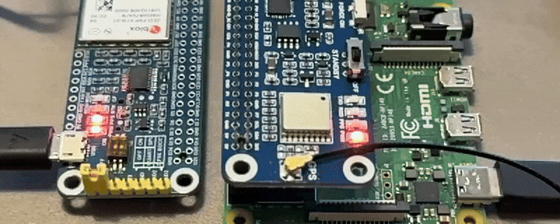
Adding the Missing Dimension: Position Tracking for Vehicle Data Logging
In one of my previous blog posts, I explored how to read live vehicle data through the OBD II port that is present in most (modern) cars. As mentioned in the outlook, the next step in my project is to combine vehicle telemetry with (accurate) positional information in order to enable more advanced analysis. To…
-

From Sky to Trail: Testing GPS Accuracy with Drones, Action Cam and Smartwatch
In the early days of mapping and cartography experiments, GPS tracks were often the starting point. Contributors to the OpenStreetMap (OSM) project, especially before 2010, relied heavily on GPS devices. They would walk or cycle routes and later upload their recorded tracks and observations to OSM. Today, GNSS-capable devices are everywhere: smartphones, smartwatches, action cams,…