Edit Stats for OSM Japan
Kate created some editing stats for OpenStreetMap Japan last Thursday. You can find her blog post here: “Quick Japan Editing Stats for OpenStreetMap”
During the creation of the layers for the “Road Status in Japan”, I log some editing information of OpenStreetMap too. As I mentioned in my blog post, I use the Geofabrik extracts for Japan (Sendai region only). They have the following bounding box (thx Frederik):
| polygon 1 1.412259E+02 3.663895E+01 1.427964E+02 4.038643E+01 1.411296E+02 4.038351E+01 1.394639E+02 3.665750E+01 1.412259E+02 3.663895E+01 END END |
 |
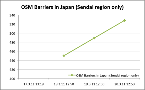
And here are several diagrams of the editing in Japan (Sendai region only):
 |
 |
 |
 |
 |
 |
 |
 |
 |
In numbers (March 20th, 2011 12:50):
- Overall amount of OSM Nodes: 5138123
- Overall amount of OSM Ways: 149978
- Overall amount of Highways: 47156
- Number of Barrier Nodes: 528
- Impassable Ways: 463
- Number of Users (Contributors): 308
- Length of OSM Ways [km]: 29049,71
- Length of impassable Ways [km]: 222,58